}
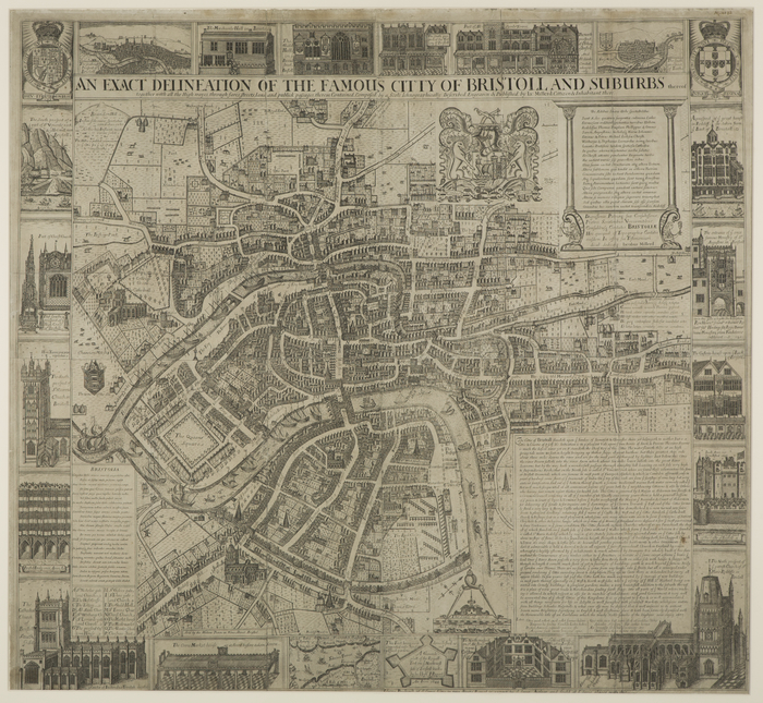
Millerd's 'The Citty of Bristoll'
James Millerd's 1673 'Exact Delineation of the Famous Citty of Bristoll and the suburbs thereof' is the first detailed map of Bristol. This view focuses on the South prospect of the city, in particular the River Avon and Frome. At this time Bristol was a thriving trading port. Millerd shows the waterway at the heart of the fast-expanding city. There is much activity on the water, from the ocean-going vessels to local ferries transporting traders and even livestock on the east side of Bristol bridge, which at this time was also the foundation for houses.